

The Ruth McKenzie Table Mountain Preserve (2960 acres) is located between Friant and Prather, on the north side of Auberry Road. The main gate is 3.3 miles uphill from the intersection of Auberry Road and Millerton Road. The map and directions to the Preserve are located below.
History
The McKenzie Preserve was acquired in trust from The Nature Conservancy in 1998. The property had previously been placed in a trust by its owner, Ruth Bea McKenzie, who wanted it to remain in ranching and open space after her death.
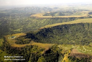
The McKenzie Preserve is primarily grassland and oak woodland that slopes upward toward the basalt lava table lands that give the preserve its name.
 Habitat
The preserve includes a significant portion of one of the flat-topped tables that are visible from the road. In spring, rain water collects in the table’s low spots, forming vernal pools. Since the basalt is impermeable, these pools hold water for several weeks or months until it eventually evaporates. The pools provide habitat for rare plants and crustaceans that “come to life” in the presence of the water. When the pools dry up in late spring, these crustaceans become seeds or cysts in order to survive the rest of the year. On the far side of the table formations, out of sight of Auberry Road, the land slopes steeply down to the San Joaquin River. These north-facing slopes sustain an excellent mix of pine forest and chaparral. The preserve also includes a 47-acre parcel along the creek on the south side.
Hikes
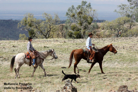
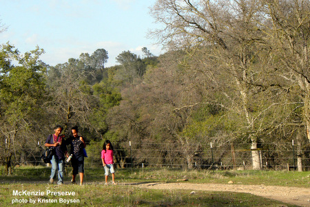
Most hikes on the preserve include a climb to the top of the table formation, where visitors can enjoy spectacular views of the San Joaquin River drainage and the Sierra Nevada mountains. In spring there are outstanding displays of wildflowers on the slopes and table tops. Trails are at the low end of the preserve. A four mile self-guided Discovery Trail along the ranch road and part of the old SJ&E railroad right of way is suitable for easy walking. The climb to the top of the table is strenuous; the table top itself is level but walking is difficult because of the rocky surface. Total distance along the trail from the parking area to the top of the table is about six miles, round trip, with just over 1,000 ft elevation change.

 Directions to the Ruth McKenzie Table Mountain Preserve
From Fresno, take Freeway 41 north. Exit at Friant Road and turn right at the bottom of the off-ramp. Take Friant Road to the town of Friant. You will see Friant Dam ahead of you. Follow Friant Road uphill, past the dam. At this point, Friant Road bends to the right and changes its name to Millerton Road. Stay on Millerton Road for 5 or 6 miles until you come to a stop sign at Auberry Road.
At Auberry Road you will see a gas station on your left. Using the gas station as your benchmark, note your mileage and turn left. Go slightly over 3 miles on Auberry Road. You will see some table mountain formations ahead. When you reach the 3 mile mark, slow down and turn left onto the preserve property.
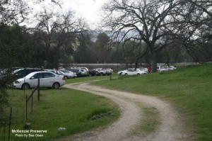
The entrance to the preserve is on the left, where you will see a large corral and a gate. Drive in at the gate and park in the parking area.